Grellingen to Zwingen Hike
- Meaghan Renner Ofori

- Aug 5, 2025
- 3 min read
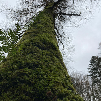
This hike is truly magical. Located in the Chaltbrunnental (Chaltbrunnen Valley) this dense and mossy forest hike, alongside a crystal clear river, has numerous caves to explore, an important Swiss cultural monument, as well as areas to picnic and grill. A perfect destination any time of the year and easily accessible with a short train ride from Basel.

Description
The Chaltbrunnental is a steep valley surrounded by 60m high cliffs. There are several caves and prehistoric sites to explore, some that have been linked to Neandrathal activity 30,000 years old! Stone Age hunters are said to have found protection from storms and wild animals here. This area is also famous for its iconic Chessiloch 'Coat of Arms' rock, which depicts over 60 works of art, painted and carved by Swiss soldiers during the First World War. The whole area is very well maintained with an excellent map system that explains the historical significance of all the sites.
Route
There are many different routes throughout this valley, but this one begins at Grellingen Bahnhof and continues through the valley, up a hill and ends in Zwingen. Public transport is the best option for this particular route as it does not loop back to the beginning. If you prefer to drive,parking is available at Grellingen Bahnhof and there are many other paths to take that loop back to the beginning, such as this one from Komoot.
Sites
Streams, rivers and canyons, oh my!
Prehistoric caves
The Chessiloch 'Coat of Arms' rock
Amenities
Accessible by train from Basel SBB to Grellingen Bahnhof (about 20 mins)
Nearby parking at Grellingen Bahnhof (Bahnhofstrasse 6, 4203 Grellingen)
Suitable for beginner hikers and children
Many areas for picnics and grilling
Due to the popularity of the area, firewood is not always available. Make sure to bring your own if you are keen on grilling.
Nearby restaurants and cafes:
Grellingen:
Pizzeria Restaurant Grello (Baselstrasse 17, 4203 Grellingen)
Tacos Grill Grellingen (Delsbergstrasse 4, 4203 Grellingen)
Zwingen:
Restaurant Bahnhof (Bahnhofstrasse 4, 4222 Zwingen)
Restaurant Löwen (Löwenpl. 3, 4222 Zwingen)
Details
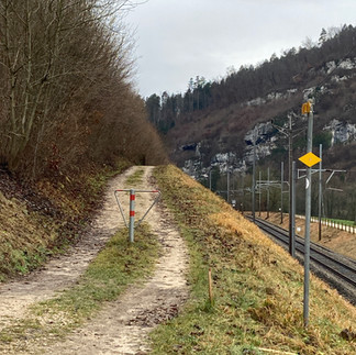
The hike begins at Grellingen Bahnhof. Exit right out of the station and follow the signs towards Chessiloch and Zwingen. The first 20 mins (map here) of this hike will take you through a residential area and then on a trail beside the rail line until you reach the Chessiloch or the 'Coat of Arms' rock. This is a lovely picnic area and a great place to stop and admire the stone paintings and carvings.
From here you will encounter a helpful map and you can decide on your route (whether you wish to loop back to the beginning or continue on to Zwingen. The area is very easy to navigate and there are several maps along the way.

As you walk along the stream, there are many caves to explore. Make sure to take note of all the historical information available to you in the maps (with the help of Google Translate). If you are wanting to continue to Zwingen be sure to take the upper road after Site 5, which will lead you up a steep path and eventually on to a small dirt road.
Continue to follow the signs to Zwingen and you will go through a logging area and beside a tree that was once struck by lighting. This road will eventually take you to Zwingen Bahnhof where you can hop on a train back to Basel.
I hope you take the time to experience this truly magical place. If you go please leave a comment, I'd love to hear about your experience!
Happy hiking! glückliches Wandern!
Sources


Comments